Channel Changes Slide 6
| 6 of 25 | << First | < Previous | Next > | Last >> | Back to gallery |
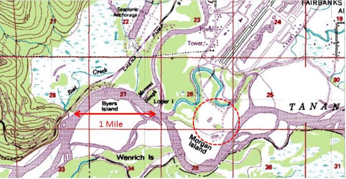
1963 U.S. Coast and Geodetic Survey (USCGS) map showing gravel pit at end of Fairbanks International Airport runway.
Notes:
By 1963, Fairbanks International Airport had a NE-SW runway long enough to accommodate Boeing 707 jets (Pan American Airways) and was located down in the floodplain of the Tanana River, close to the “traditional” confluence of the Chena and Tanana Rivers. (The so-called mouth of the Chena River could be defined differently over geological time. Until the upper end of Chena Slough was blocked off in about 1949-50 (?) glacial and silty Tanana River water flowed through downtown Fairbanks under the Cushman Street Bridge. Clear Chena River water became diluted with silty water at what is now the mouth of Badger Slough, so the mouth of the Chena was quite some distance upstream of its traditional mouth).
This 1963 topographic map of the area suggests that a serious gravel mining operation had already removed sufficient gravel from Morgan Island to have produced a pond, mapped here at the southern end of an access road from the Airport (circled).