Project Jukebox Survey
Help us redesign the Project Jukebox website by taking a very short survey!

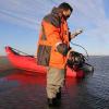
Tahzay Jones
Tahzay Jones was interviewed on March 29, 2019 by Leslie McCartney and Katie Cullen at the offices of the regional headquarters of the National Park Service-Alaska in Anchorage, Alaska. In this interview, Tahzay talks about his work as the Oceans and Coastal Programs Coordinator for the Alaska region of the National Park Service, which has allowed him to be involved with monitoring and studying coastal ecosystems of Alaska and the effects of environmental change. In this interview, Tahzay talks specifically about his work with coastal lagoons, coastal erosion, changes in vegetation, collapsing permafrost, and changes in sea ice and weather patterns around the Seward Peninsula and in Bering Land Bridge National Preserve. He also discusses his field work, the importance of protecting cultural and natural resources, human adaptation to change, and the importance of educating the public about the changing environment in the north.
Digital Asset Information
Archive #: Oral History 2018-14-10
Project: Observing Change in Alaska's National Parks
Date of Interview: Mar 29, 2019
Narrator(s): Tahzay Jones
Interviewer(s): Leslie McCartney, Katie Cullen
Transcriber: Ruth Sensenig
Location of Interview:
Location of Topic:
Funding Partners:
National Park Service
Alternate Transcripts
There is no alternate transcript for this interview.
Themes
After clicking play, click on a section to navigate the audio or video clip.
Sections
Personal and educational background
Getting a job with the National Park Service, and coming to Alaska
Researching change in Alaska's coastal areas
Local concerns about change in the environment and changes in human activity
Development of the lagoon monitoring protocol
Image mapping the northern coast of Alaska, and collaboration with the ShoreZone program
Research on water flow, lakes drying, collapsing permafrost, and erosion on the near-shore and inland environment
Changes in vegetation and habitat, and affect of changes in currents and sediment flow on barrier islands and coastal lagoons
Changes in sea grass beds in lagoons
Changes in water temperature, changing storm patterns, and erosion
Thermal erosion and melting permafrost
Importance of shorefast sea ice, and affect of storms, wave action, and erosion
Scientific research to support resource management, including subsistence access
Current research on lagoon systems, coastal processes, and erosional change
Monitoring coastal erosion, and protecting cultural resources
Protecting paleontological resources
Doing summer fieldwork
Doing field research on tides, fish, lagoons, water quality and marine debris
Research on lagoon connectivity and influence of the ocean on the system
Human adaptation to the changing environment, and studies on the impact of ship traffic and noise
Change in salinity of lagoons
Coastal debris
Affect of algae blooms on marine and coastal systems
Educating people about the changing environment in the north
Click play, then use Sections or Transcript to navigate the interview.
After clicking play, click a section of the transcript to navigate the audio or video clip.
Transcript
LESLIE MCCARTNEY: So good afternoon. Today is Friday, March 29, 2019. We’re at the National Park Service, Alaska Regional Headquarters, I suppose. TAHZAY JONES: Alaska Regional Office, yeah. LESLIE MCCARTNEY: Yeah. In Anchorage, Alaska.
Um, we are here to talk about the observing climate change and environmental change in two parks in Alaska, the Gold Rush National Historic Park and the Bering Land Bridge National Preserve. And it’s going to be an oral history project, hopefully on Project Jukebox at the University of Alaska in Fairbanks.
So welcome, and I want to thank you both for being here today. Um, I’m Leslie McCartney. I’m the curator of oral history at UAF, and I am here today with Katie Cullen and Tahzay Jones, who I’m going to let introduce themselves.
KATIE CULLEN: Thank you. I’m Katie Cullen. I’m the interpretation and education program manager at Bering Land Bridge National Preserve. I’m based in Nome, Alaska. LESLIE MCCARTNEY: Great.
TAHZAY JONES: And I’m Tahzay Jones. I’m the oceans and coastal programs coordinator for the Alaska region here in Anchorage.
LESLIE MCCARTNEY: Great. Well, I really want to thank you. You’re our first person to interview on the Bering Land Bridge side of things. My colleague Karen has interviewed some people on the Klondike, so we’re -- we're really glad to have you.
Um, can we just start off with some biographical information first, where you’re from, your education, things like that?
TAHZAY JONES: Sure. Um, so I grew up in Arizona in the middle of the desert, which doesn’t, you know, exactly match to the oceans role that I normally have, but that’s where I grew up.
And through a series of, we’ll just call it life lessons, I’ve managed to make my way gradually from there down to the tropics and then ultimately up here to Alaska, where I am working now.
And in the course of that series of -- of events, I picked up my undergraduate degree from the University of Chicago, and I have my PhD from the University of Miami.
LESLIE MCCARTNEY: So what was your undergraduate study then, in environmental?
TAHZAY JONES: So I did actually a combination of work. So I focused my efforts on biological sciences, sort of.
I was given a choice, because the University of Chicago at that time didn’t actually give you multiple degrees at the same time. So they said you can choose because you fulfilled the requirements for both of them, so you can choose which one you want.
I had done art design as one and completed the requirements for that, and I had also done biological sciences, so naturally, I said, well, you can always do art, but for science, you need a degree. So I’ll take my degree in biological sciences, even though I had been really focused in art and design.
LESLIE MCCARTNEY: Wonderful. So where did you do your PhD work, then? And what was your thesis topic?
TAHZAY JONES: My PhD work was at the University of Miami at the Rosenstiel School, and I focused on the -- I mean, the title of the dissertation itself was “The Biology and Ecology of Eight Thecate Hydroids in Biscayne Bay, Florida, and Their Potential Uses Bioindicators.”
Which is a really long way of saying, I looked at invertebrate animals in the marine environment and figured out how the influences from coastal runoff impacted the near-shore environment.
So it was really focused on chemistry, biology, and -- and the physical dynamics of the interactions and processes that go on on the coast.
LESLIE MCCARTNEY: Oh, interesting. So how did you get inv -- did you go from there to being in the Park Service, or how -- how did your career progress?
TAHZAY JONES: Yeah. So that’s the part that becomes a little bit of a divergent turn. I finished my PhD and said, I’m done with this. I don’t really care about doing science at all. I’m going back to art.
And I walked out of my PhD after I got my last signature, handed in my dissertation, and walked over -- I didn’t walk -- I walked to the airport and flew over to California and started my life as an artist for a while.
And -- and I ended up working in a handful of theater companies. I ended up with another person being a founder of a theater company. KATIE CULLEN: Wow.
TAHZAY JONES: And then started doing some of my own artwork, which included photography and videography and -- and just talking and interviewing to people about their perspectives of how the US was engaging on foreign soil, and so I kinda traveled around quite a bit.
LESLIE MCCARTNEY: So what year -- what year was this, Tahzay? Sorry to interrupt. TAHZAY JONES: This would’ve been in the early 2000’s. LESLIE MCCARTNEY: Ok.
TAHZAY JONES: And then I had a friend of mine who called me up and said, "Hey, we really need you back in science. I need your help." I said, "Well, all right. I guess I can give you some help."
LESLIE MCCARTNEY: And what help did they need? TAHZAY JONES: And so, well, they just needed some science help for some of the work that I did. And so I said, all right. And then I realized that, wait a minute, I do like science. It’s really fun. And I’m missing a piece of it.
So when I had been in college, I had worked for the Forest Service doing silviculture work in, you know, working in trees and forests in Idaho, and I got to see kind of what happened in the upper areas of rivers and streams and those ones.
And then I’d be there before a forest fire would come through and then after, and I’d help with the rehabilitation of that particular area.
And so, when I did my coastal work, I was really focused on, literally, what happens when the rivers come out and -- and they go into the ocean.
And so I said, I really want to find out what’s going on in between. And there’s no better place to do that than looking at large river and lake systems, which Alaska is, you know, that’s the place.
And so, I applied to come up here to Alaska and -- and work just as a technician. So you know, I was a PhD-level technician for the Park Service, purely because I wanted to learn and understand what rivers and lakes actually -- how they function and what they were like.
And -- and I just, yeah. I’m one of those people that doesn’t believe, just ’cause you have a PhD, you know everything. In fact, you learn how much you don’t know, and you keep going from there.
LESLIE MCCARTNEY: So when you came to Alaska, was it to Anchorage, or were you stationed somewhere else? TAHZAY JONES: No. I was stationed out in King Salmon. LESLIE MCCARTNEY: Hm.
TAHZAY JONES: And so I was working for Katmai National Park, and they also administer down to Aniakchak, and so I sort of worked in Katmai, Alagnak, Aniakchak area. Um, all on the Alaska Peninsula. And so, I spent a couple years there, doing some -- some work for them.
And then ultimately got transferred down to Hawaii and the Pacific for a whole ’nother set of reasons, and gradually tried to figure out how to come back up here. ’Cause I love Alaska.
LESLIE MCCARTNEY: Right. So how long have you been back up here now, then? TAHZAY JONES: So I’ve been back up here now for eight years. LESLIE MCCARTNEY: Ok. TAHZAY JONES: Running towards nine. LESLIE MCCARTNEY: Very good. TAHZAY JONES: Yeah.
LESLIE MCCARTNEY: And so you said you were first down in the Kenai area. What did -- did you find down in there? Did you find that your PhD work that you had done with rivers going into the ocean, was that -- did you find similarities here?
TAHZAY JONES: Yeah, so not in -- not in Kenai, but on the -- LESLIE MCCARTNEY: Sorry. TAHZAY JONES: -- Alaska Peninsula, but -- LESLIE MCCARTNEY: -- Alaska Peninsula. Sorry, my mistake.
TAHZAY JONES: But there, you know, so there’s a lot of similarities that you can tie in terms of the ways that studies move forward or the way that studies get done. There’s a lot of similarities that you can tie, and there’s a lot of differences between the two. LESLIE MCCARTNEY: Hm.
TAHZAY JONES: And so I found that there was a mix of things that were going on, and -- and mostly I was there to learn, so I was working with other researchers that were there. So I learned a ton from the other researchers that were -- that were down.
And I was engaged with the inventory and monitoring program for the Southwest Alaska network. LESLIE MCCARTNEY: Hm.
TAHZAY JONES: And so I got to engage with a whole bunch of researchers from that -- from that standpoint.
LESLIE MCCARTNEY: And so how did you become involved in the Bering Land Bridge area, or is that just part of lakes and oceans with the greater part of Alaska?
TAHZAY JONES: Yeah, so when I came back to Anchorage and the position that I’m in now, I was sorta given really almost no direction, in terms of what my position would be. It was a -- it was a new position where the Park Service had recognized that we really need to start putting effort into looking at our -- our oceans and coastal resources.
And so I was given the direction, this is -- this is not a direct quote, but it’s pretty close. "We know only a little bit about" -- this is -- so I was hired, really, with a -- a panel that included some people from the Washington office.
And in the Washington office, their comment to me was that, "We know really not that much about what’s going on in Alaska in general, and we know even less about what’s going on in the Arctic. And sometimes Congress asks us questions, and your job is going to be to figure out what those questions are going to be and be ready to answer them for us." KATIE CULLEN: Wow. LESLIE MCCARTNEY: Whoa.
TAHZAY JONES: And so, that was my job. I said, "All right. Well, sounds great. Sign me up."
And -- and so, I put in, in the very first meetings that I was here, I think I hadn’t even been on the job but maybe a week and a half, two weeks, and um, immediately was engaged with the superintendent from, at the time, the Western Arctic Parklands.
And I headed up and just started to say, "All right. Let’s go take a look. Let me see what I need to do."
And so, that began my work up in the, um, generally speaking, in the Arctic region for the National Park Service.
LESLIE MCCARTNEY: So what were your first impressions? TAHZAY JONES: My first impressions were that, this is an amazing place because it can -- it -- it looks for all the world to me like it’s functioning in the way that it appropriately should be functioning.
Like, there’s not a lot of -- of, uh, disturbance, to the way that the land itself is actually functioning. You don’t have dams built up on it. You don’t have tons and tons of people, like, trying to modify the coastline. That -- that is an extremely small portion of what’s -- what’s actually there.
So from a systems standpoint, it was amazing to see a -- a landscape where you just didn’t have a lot of modifications that were going on, and so, really what you were going to be looking at is natural processes. What are the -- what are the -- what are the things that nature is gonna do to influence the way that this system is growing and the way the system is developing, and the way it’s changing.
And that was kind of a big first impression of what I saw when I was up and down and along that coast.
And that doesn’t mean that weren’t people on the coast. It just means that there weren’t a lot of modification to the coast.
And so, that left the landscape much more free to be able to change and respond to, yeah, environmental changes as it would naturally occur.
LESLIE MCCARTNEY: So if that work hadn’t really been done before, is that what you’re going to be kind of using as your baseline for looking at change?
Or have you looked at research, like historical documents, or records, or anything like that, too? TAHZAY JONES: Well, I mean, so that was like, two weeks of coming in. LESLIE MCCARTNEY: Yeah. TAHZAY JONES: I went up and looked and saw. That was my initial impression. LESLIE MCCARTNEY: Yes.
TAHZAY JONES: And then, yeah. Then I went in and started saying, ok. Well, what do I actually see. I started talking to people who had been there, trying to understand what, you know, and there’s a huge amount of knowledge. LESLIE MCCARTNEY: Um-hm.
TAHZAY JONES: I mean, you have the people that -- that live there, that have lived there for generations, have a ton of knowledge about this area.
And so, the opportunity to be able to discuss that with them, the opportunities to be able to just look and see what research has already been done, and how can it tie.
And sometimes that research isn’t right in the parks, but they might be in areas that are nearby are really relevant to the park systems.
And so, you know, it was a great chance to start to go in and look at that and see, what did they see. And -- and -- and there’s not as much as I would’ve hoped, I’ll put it that way.
But there was some, and so it was -- it was good to be able to start thinking about that and thinking about, you know, your first question there is ok, well, then what are going to be my concerns? What is it that’s going to, if -- if -- if it’s not being altered, and it’s not being, you know, heavily changed, then what are those things that are gonna heavily change what’s going on?
And so, then you start looking at, what is going on around? What are the bigger -- what are the bigger issues that we can -- that we can see, um, coming up?
And, you know, no surprise, the people in the area were able to point out right away, this is what we’re concerned about, and they were able to start listing off things that they were concerned about.
LESLIE MCCARTNEY: And what were some of those concerns? TAHZAY JONES: Some of the biggest concerns were really, at the time, they were -- there was --
I guess I would put it into two major categories. One being environmental categories, and one being, um, human development categories.
And so, on the human development category side, there was real concern about shipping traffic, increases in shipping, moving up and around and through the area.
What would happen if, you know, we have an oil spill or marine incident, and how is that going to affect our ability to subsistence, um, to the subsistence lifestyle?
And that was a -- that was a real concern, and it was a big concern. And -- and that was probably one of the biggest concerns that sort of grew up in that, sort of, human development side.
And on the -- on the natural -- natural resource/environmental side, it really kinda stemmed down to, well, things are changing, and they’re changing really fast, and -- and so we have this combination of, ice is no longer -- it’s not here when it should be here, or it’s not as thick as it should be, and so there was a real recognition, very much so, about how -- how the ice was going to influence --
Maybe not how the ice was going to influence, but the changes of ice. And -- and what was happening with the changes in ice.
And tied to that were things like erosion and how the erosion rates were increasing. LESLIE MCCARTNEY: Um-hm.
TAHZAY JONES: And whether the rates were increasing or not almost was less of a concern than to say, it’s happening, and it’s not stopping. And -- and it’s a real problem.
LESLIE MCCARTNEY: And along with the ice going out, were people also concerned about the change in subsistence habits? TAHZAY JONES: Well, I didn’t get that as much. LESLIE MCCARTNEY: Ok.
TAHZAY JONES: And that doesn’t mean -- that doesn’t mean that they weren’t concerned about it. It just -- it just means that kinda the two priority things that started to come up were like, what really is going to change here, and -- and how can we start looking at that. And those were kinda the things that I ended up focusing on.
But -- but there actually is a real concern about access to subsistence areas, and how what the access to subsistence areas change. But that’s much less of a concern. LESLIE MCCARTNEY: Hm.
TAHZAY JONES: In the bigger picture of all -- and again, I don’t want to -- I don’t want to say it’s not a concern. LESLIE MCCARTNEY: Yeah.
TAHZAY JONES: It’s -- it’s just less of the concern at the time when I was -- when I was going through and trying to look at and understand what was happening.
LESLIE MCCARTNEY: So tell us about your work, then, since those first impressions. How has your work gone? What have you been doing?
TAHZAY JONES: Yeah. We took a lot of the information that we got, and -- and started putting it together to say -- to come up with, really, a strategy of how to --
So I work with the park superintendent, the park resource managers at the time, the inventory and monitoring program, which already had established a process that it was going through to look at long-term environmental changes through their vital sign monitoring program.
And so I got involved both with the inventory and monitoring vital sign side of it, and began engagement with the lagoons monitoring process, and ultimately ended up working with a handful of other researchers on just the development of the lagoon monitoring protocol.
How do we -- you know, how do you go about monitoring these areas, and what do you look at, and -- and what’s gonna be the most relevant things that are going to matter from a management standpoint to understanding what’s going on in the systems, and how those changes to the systems are relevant to, um, direct management of the area.
And so, that was one aspect of where I started, um, doing a lot of work.
And then another aspect where I started doing a lot of work really had to do with the concern related to shipping. And so, we began moving down a pathway of looking at what are, ok, let’s look at the worst-case scenario. We have a spill in the area. What do we do about that?
And so, we started looking at the geographic response strategies, and saying, ok, if there is -- so the strategies are -- these are -- these are basic recommendations. If something happens here, this is the initial, sort of, response that you’re looking at. And -- and that may change, but this is the initial thing that you’re looking at.
And so, these areas are really, really remote. You want that initial, like, here’s what we’re gonna start with, and this is the recommendation to be right.
Now -- now the state is ultimately responsible for that, but they can absolutely have help, and -- ’cause they can’t go everywhere. And so, we really wanted to work with the state and say, all right, we’ll go out and take a look at these tactics that are -- that are sort of designed for very specific areas all along the coast, and start saying, um, do they make sense? Can you do it?
Or what would need to change in order for these tactics to be, maybe, more effective from the get-go? And then you change it however you need to change it based on what the situation is.
But that’s what we started going down the road of looking at, and put in a lot of effort there, just generally getting to understand how that system is -- is functioning, how it’s working, and -- what the -- how to prevent something from happening internal to some of the really important habitat areas.
So that was one road that we went down. And another road that we went down was to say, ok. Well, what about this shipping aspect? And how are vessels moving in and about and through the area?
And so, we started -- again, working with a group of folks, including the Aleutians and Bering Islands LCC, and, um -- and the Wildlife Conservation Society, and a handful of other people who were very interested in what is actually happening with the shipping movements there.
And -- and so we started going down the road of, let’s take these satellite im -- information and figure out where ships are, when they are, how frequently they’re moving, how fast they’re moving through the area, and develop a model that tells us that, so that you can really get a good picture of what’s actually happening.
’Cause that became really apparent, is that all these pictures that we’re seeing about what’s happening try and compress time into a single picture, and sometimes that doesn’t convey what’s really going on.
There -- there -- it can look a lot scarier when you take an entire year’s worth of tracks versus, you know, sort of a shorter period, or you’re looking at what individual vessels are -- are potentially doing.
So we began looking at that, just to try and get a handle on what does this mean when they say there’s going to be, you know, a 150 percent increase in vessel traffic or 500 percent increase. Like, wrap your head around that. LESLIE MCCARTNEY: Yeah.
TAHZAY JONES: It’s difficult to understand what that means unless you have a good picture of what you’re seeing on a day-to-day or week-to-week or month-to-month basis. And so that’s what we were trying to get at.
And that’s where a lot of the focus of effort that I started with, um, really went.
And there was one other small, little piece that was, let’s just get images of the coast, so that we can have a picture to -- to -- to refer back to. This is what it looked like.
And so in 2012, we were able to image the entire coast, from -- well, we kinda combined projects with another group that was working, as well, and were able to ultimately combined getting images of the coast that went from Wales.
Our section of it, that we worked on, went up to Point Hope, and then there was another section that went from Point Hope all the way to Canada.
And so, we were able to get a really fantastically useful imagery along the coast there through the ShoreZone program.
LESLIE MCCARTNEY: Wow. Was that the first time that large of a -- of a land -- shore coast had been actually pictured? TAHZAY JONES: So the answer to that is both yes and no. LESLIE MCCARTNEY: Yes and no.
TAHZAY JONES: At the -- at the level and what we were doing, um, the work for, yes. But satellites have been taking imagery of the coast for years.
The difference is, really comes down to the resolution that you’re -- that you’re looking at.
And, you know, satellites now are able to do a really good job, but they’re looking straight down, usually, on the coast. And these images were taken obliquely, and, you know, so -- at an angle, right.
And the difference between taking it straight down and at an angle is straight down is really helpful for doing measurements and those kinds of things. But at an angle is really the perspective that you would understand it from, more -- like -- like we are never this high off -- LESLIE MCCARTNEY: Right. TAHZAY JONES: Way above, looking straight down, that’s -- that’s usually not the way that we’re -- that our -- our mental picture of the world has generally developed.
Like, we look at things from the side. We have an oblique angle to the world.
And so, when you’re looking at these images from, you know, the human perspective, it’s a lot easier to kind of grasp what’s happening when you’re looking at it from an angle, rather than straight down. LESLIE MCCARTNEY: So I imag --
TAHZAY JONES: That’s for some people, not for everybody.
LESLIE MCCARTNEY: I imagine it was a very expensive project to do. That was 2012. What are the plans to do them in future, to compare and contrast? Or is there?
TAHZAY JONES: Yeah, right now there’s not necessarily a plan to do it in the future. We are, even this year, planning to get back out onto the coast and do some imaging of those coastal areas, but not in the same way that we did them before.
That was -- that was a major endeavor. It took a lot of work, a lot of coordination, and a lot of communication, um, with the communities that -- that given the budgetary situations that we have, it’s just not really feasible in the -- in the near future to do again.
KATIE CULLEN: And ShoreZone was -- is like a big collaborative group? TAHZAY JONES: Yeah, ShoreZ -- KATIE CULLEN: Remind me again, I guess, yeah, who all is involved in that.
TAHZAY JONES: Yeah, ShoreZone is a -- is a big, collaborative group that, um, I guess the sort of main coordination is -- is being done through NOAA here in the US. KATIE CULLEN: Um-hm.
TAHZAY JONES: But the partners have -- have literally been every single federal agency in the DOI (Department of the Interior) that you can think of that’s a land management agency. We’ve all participated in trying to move forward, getting this imagery.
It’s really helpful from a spill-response standpoint. LESLIE MCCARTNEY: Yeah.
TAHZAY JONES: And that’s really, kind of, the biggest selling point of the ShoreZone project as a whole. But ShoreZone has actually imaged from, I think, the Oregon border all the way up through Alaska and around to the Arctic Canadian border, minus a handful of the Aleutian Islands.
And so, it’s a -- it’s a huge, huge group of people. It’s not -- yeah, there’s no way one single person can pull all of that off.
But it -- it’s a whole bunch of entities, federal, non-profit, that are all sort of putting into the mix to try and make this imagery available.
And the people that are running it now are out of Canada. KATIE CULLEN: Hm. TAHZAY JONES: Yeah. So this is sort of a Canadian -- I think they’re a Canadian firm. Anyway, they were when I did it in 2012. KATIE CULLEN: Um-hm.
TAHZAY JONES: But -- but it’s, yeah. It was sort of their -- their brainchild, and then that’s been spread throughout -- throughout western northern -- the continent of western North America, I guess, for that matter. LESLIE MCCARTNEY: Yeah.
TAHZAY JONES: Yeah. It’s -- it’s -- it’s a really fantastic program, and it’s done a really good job at giving usable imagery, typically flown at low tide, which is another thing that you don’t get, this tidal coordination that goes on. Um, with satellites, it’s just kinda like, when the satellite is passing over, it’ll take a picture, and it might be low, it might not.
And -- and so this one is specifically timed for that, and that makes it really, really helpful for spill-response.
I mean, you can be responding in, well, it’s the Arctic, right, so -- or even sub-Arctic, for that matter. It -- it’s all over, and if you have an incident that happens in the winter, which I can almost guarantee you, the incident will happen at the worst time that you can imagine.
It’ll happen in the winter when the light is at the lowest point in time. Well, this gives you, like, perfect, you know, light image that you can see at low tide, so you can understand what’s the habitat around that area. What’s, you know, potentially, of concern, and, you know, you can think about what the options are in terms of trying to address those -- those areas that might -- you might be concerned about. KATIE CULLEN: Right.
LESLIE MCCARTNEY: Just one thing I was thinking as you were talking, and it’s not related to the oil or the spills, but you had said that your PhD thesis was on how lakes and streams flowed into -- TAHZAY JONES: No, no, no. LESLIE MCCARTNEY: No? TAHZAY JONES: No, it’s -- LESLIE MCCARTNEY: I got that wrong?
TAHZAY JONES: It’s just -- it’s -- it’s how run-off from -- LESLIE MCCARTNEY: Run-off. TAHZAY JONES: Uh, yeah. So it could be what we call sheet flow. LESLIE MCCARTNEY: Um-hm. TAHZAY JONES: Which you would call just the water that goes off onto the -- LESLIE MCCARTNEY: Yeah.
TAHZAY JONES: Versus what gets put into a river or a canal, and, you know, put out in one point location, so -- so I looked at all of that.
Like, what happens when you have this concentrated water that is coming from a basin that will then, you know, all come together and go out. LESLIE MCCARTNEY: Drain out.
TAHZAY JONES: And -- and what does that mean when you’re talking about an agricultural run-off. What does that mean when you’re talking about an urban run-off.
And what does that mean when you’re talking about, sort of, an unimpacted -- or, I should never say unimpacted. A relatively low-impacted natural environment.
And what are the differences between those, what do they look like, and how does that happen?
LESLIE MCCARTNEY: So I guess that -- what got me thinking, and I wasn’t very articulate when I said that, but that’s kinda what I was thinking, is a lot of the small, shallow lakes that we have now in Alaska and the Northwest Territories and the Yukon in Canada are actually drying up. TAHZAY JONES: Yep.
LESLIE MCCARTNEY: So how is that gonna affect -- ?
TAHZAY JONES: Yeah, so this has been a whole ’nother piece of where, you know, I’m starting to -- to look. And -- and we have a lot of concern.
So in the course of having been out there, and starting to look and see, like, what’s happening? What am I seeing that -- you know, people can tell me all these things that are happening, but there’s also some amount of, you know, knowledge that I can gain from -- from actually being out there and looking at what’s happening,
And -- and you do get these changes in -- well, I don’t know what the most appropriate term is. I’ll call it thermokarst. But anyway, permafrost.
And -- and you can see areas where you get collapses of the permafrost, and then that -- that permafrost, the liquid from that, is just sort of running off, and so you get, in essence, a thermal erosion that’s going on in addition to your, you know, normal erosion that you would see with the wind and wave action kind of thing.
And so you can see that happening. You can also see, in general, what looks to be decreases in the elevation of, you know, some -- some areas where you’re getting drowning of the tundra that’s happening, which is really changing the -- the near-shore habitat in -- in some of these areas where you’re seeing that happening.
And then, yeah, you have this sort of, what’s happening up on the land in the coastal plain where they -- lakes suddenly just drain and create no-water habitat. It now becomes, you know, filled with vegetation.
And -- and that’s certainly changing. That’s certainly, it’s a change in habitat that’s going on along -- you know, all throughout. It’s not even just on the coast. It’s happening in a lot of places.
And -- and you can definitely see that -- see that there, and, you know -- Fish might be losers, but maybe some birds are winners? I don’t know. You kinda gotta look at it, you know, it’s just a change in habitat type.
LESLIE MCCARTNEY: Right. And with the change of habitat, when it used to be water, now there’s more willows, now there’s more trees, and with that comes more animals, that all changes, too.
TAHZAY JONES: Well, there’s -- there’s certainly changes that are going -- going on, and you can -- you can visibly see some of those changes that are happening for sure, but, yeah, I -- it’s happening.
LESLIE MCCARTNEY: It’s happening.
TAHZAY JONES: There’s nothing I can say other than, it’s happening, and that rate of happening, how fast it’s changing, how fast it’s moving, um, all those kinds of things.
Like, it’s hard to say what the implications of that are going to be for me. LESLIE MCCARTNEY: Um-hm. TAHZAY JONES: There’s other people that might be really good at saying that, but -- but for me, I -- I -- I think that there’s a lot more that’s happening in terms of ramifications of these changes than -- than we fully understand.
LESLIE MCCARTNEY: Can you give me an example? TAHZAY JONES: Yeah, sure.
So, say you have a barrier island, and your barrier island is eroding, and -- and that erosion leads to a breach in the island.
And so, now you start changing, literally, how the ocean and that lagoon that’s behind are interacting.
And that means that you might start getting a change in the general current flow. Your -- basically, your small-scale oceanographic principles are gonna still apply.
If I have water coming into this basin from, say, the southern edge, and I have more water coming into this basin from the northern edge, it’s going to cause a different flow pattern. It’s going to move around.
Within these lagoons, there’s lots of tidal flats. There’s berms that build up, and those are gonna change. And when those change, they change how the flow is moving.
Well, this area happens, especially in Bering Land Bridge, happens to be the farthest northern extent in the Western Hemisphere of sea grass -- of sea grass beds.
And so, some of those sea grass beds are internal to these lagoons, so if I get changes in how the water flow is moving within the lagoon, I could entirely cover my sea grass beds with sediment faster than they can, you know, grow.
And so, you could lose sea grass beds, which tend to be nursery grounds for a lot of the fishes. Um, and -- and it tends to be habitat and fishing area for some of the water fowl that are coming in and -- and feeding in those areas.
So, yeah, there’s, like, real habitat changes that can be happening if some of this starts to happen.
Um, but, you know, that said, I mean, we see these changes. I mean, I’ve watched, you know, entrances to some of these lagoons up in northern Bering Land Bridge, I’ve literally watched them, and I can -- I take my little GPS track as I do surveys back and forth across the entrances, to, you know, look at depth and see how the -- the depth and where the channels are.
I look at those, and I’ve -- I can see my tracks from, you know, four years ago, like, now I’m on land. Where my -- my picture, literally my -- my aerial image tells me I should be in the water, but I’m on land. KATIE CULLEN: Wow.
TAHZAY JONES: Because it’s shifted that much. Like, they -- they are changing in a very significant way.
And I’ve seen people who I know they’re navigating, ’cause it’s night time, and they’re navigating by GPS, and they’re going by the last track that they had, and I’ve watched them ground themselves on -- on tidal flats. KATIE CULLEN: Right.
TAHZAY JONES: And it’s like, well, yeah, last year that was open because I have that same GPS track right here. LESLIE MCCARTNEY: Wow.
TAHZAY JONES: And -- and it’s, you know, that to me becomes a problem, not only from the standpoint of, hey, we might lose a sea grass bed here or there, but it becomes a problem from a standpoint of, that’s a real human life issue.
If you start, you know, having accidents, I mean, this is not super forgiving terrain. Or water, as the case may be.
And so, if you -- so if things like that are happening, are they gonna happen more often? Are they going to happen, you know, what -- what does that mean?
And that's why -- that’s why I say, I don’t think I am qualified to be even able to say what the ramifications of all this are, 'cause I think they are far beyond what we would initially expect, and they go -- they run the gamut from environmental changes to actually affecting people. And that matters. And it matters a lot.
LESLIE MCCARTNEY: Yeah. I’m just thinking, what’s the point of having nautical charts anymore, then if, you know, things happen this quickly? TAHZAY JONES: Well, there’s the benefit. There’s no nautical charts. LESLIE MCCARTNEY: The deeps aren’t, but --
TAHZAY JONES: NOAA hasn’t been able to -- Alaska’s a big state. LESLIE MCCARTNEY: Yes.
TAHZAY JONES: And they just -- there are places that they’ve been able to get to, and places that they haven’t. And this is one of those places that’s a blank spot on the map.
LESLIE MCCARTNEY: Wow. That’s amazing. TAHZAY JONES: So. LESLIE MCCARTNEY: Yeah.
KATIE CULLEN: Can -- can I jump in with a question -- ? LESLIE MCCARTNEY: Of course. KATIE CULLEN: -- about --
I’m curious about the, um, I don’t know much about the eel grass beds, like how big they are, even. Are they distributed throughout all of the lagoons? Like, Ikpek, Cowpack, like, are they in all of the areas? Or like, set us up with, like, an image of -- TAHZAY JONES: An image?
KATIE CULLEN: What they kind of -- if you’re out there, what you’d encounter. TAHZAY JONES: They hide out in certain parts of the lagoon. KATIE CULLEN: Ok.
TAHZAY JONES: So they’re not throughout the entire lagoon. Um, large -- large areas of the lagoon are fairly sedime -- basically, sandy. KATIE CULLEN: Um-hm.
TAHZAY JONES: They -- they -- A lot of it has sandy bottom, and a lot of that is, I think, because of the way that the currents are moving within the lagoons.
You’re just kind of -- imagine a desert. Right? It’s easy for me to go back to a desert, right. Imagine a desert, where you have sand dunes that are blown by the wind, and those sand dunes move. KATIE CULLEN: Um-hm.
TAHZAY JONES: Well, effectively, the same thing is happening, except these dunes are just underwater, and it’s the water that’s moving them instead of the air.
So these dunes are moving around within the lagoons, to some degree, and I -- and the places where you find some of the sea grass beds are places that aren’t really getting buried. KATIE CULLEN: Um-hm. TAHZAY JONES: By those as they move around.
Um, and I have by no mean -- no means, figured out the full extent of where those sea grass beds are. I have just come across them. KATIE CULLEN: Um-hm.
TAHZAY JONES: As I’ve been looking for certain places or points within the lagoons themselves, and you sort of, you find one, and then you’re like, "Oh, well, let me look at this."
And -- and on the ground, they’re fairly large. KATIE CULLEN: Um-hm. TAHZAY JONES: But they’re --
You can also tell they’re not like these dense, lush sea grass beds like you would find, say, down in Izembek Lagoon or something like that on the Alaska Peninsula, or someplace where they just grow real thick.
They’re -- they’re not as dense. They’re -- they’re smaller, but -- but they’re there.
KATIE CULLEN: And are there -- I’m guessing that’s going to be a great spot for, like, a nursery for certain species to kinda before they head out of the lagoon, per chance, but are there also organisms that are, like, munching on the sea grass as a source of -- ? TAHZAY JONES: Oh, yeah. Yeah.
KATIE CULLEN: I guess, I don’t know what -- what eats the sea grass? TAHZAY JONES: Well, you can -- you can find little snails running around on top of them. KATIE CULLEN: Ok.
TAHZAY JONES: That’s -- that’s frequently what you see. You’ll also see little worms that attach themselves to the blades of the sea grass. KATIE CULLEN: Mm, um-hm.
TAHZAY JONES: So there’s -- there’s a handful of things that are -- that are out and, I’ll just call it playing in the sea grass.
LESLIE MCCARTNEY: Does the temperature of the Bering Sea have, um, an effect on the way these currents are moving? Are they changing due to the warming of the waters? TAHZAY JONES: Yeah, that’s an oceanography question. LESLIE MCCARTNEY: Right.
TAHZAY JONES: And there are fantastic people at the University of Alaska who are looking at exactly that question.
Um, I can say that -- that we know generally the circulation patterns that are moving, and there are certainly, um, as storms pass through the Bering Strait, they can propagate waves up and into the southern Chukchi and some of those can even propagate into the lagoons,
and so we can see tied to some of the storm patterns, we can see changes in, like, lagoon water levels.
And so, that’s something that we’ve been looking at, is how do the water levels change?
And -- and we’re literally in the process of moving forward a project right now that is tying the oceanography of the offshore to what’s happening inshore, to get exactly at that question. LESLIE MCCARTNEY: Right.
TAHZAY JONES: What -- how are these linked, and how are they tied? And that will help us understand more, what happens if we, you know, change the way that that interaction is taking place.
’Cause some of these areas in the barrier islands that are forming the lagoons are getting very, very, very skinny. LESLIE MCCARTNEY: Hm.
TAHZAY JONES: And -- and -- and we’re talking less than 100 meters at -- in points, where the islands will just almost breach, and then not quite.
But -- but we -- I’ve been able to collect quite a few images where you can see overwash areas that look like they’re trying to get across, and there are certainly places where it is happening.
Um, and we just see areas -- sometimes they’ll breach and then fill themselves right back up again. So that -- that happens, too.
LESLIE MCCARTNEY: And that actually protects the coast, so without those there, I would imagine the erosion on the coast would be so much worse. Is that correct?
TAHZAY JONES: The barrier islands are sort of the primary erosional point. LESLIE MCCARTNEY: Ok. TAHZAY JONES: That’s going on.
But there are -- the lagoons that are there are big enough that you can actually see changes that are happening inside the lagoons, as well.
Um, they’re very large and to give you an idea of the, sort of, what, like the tidal change in the lagoons is, I don’t know, maybe -- maybe less than a foot of tidal change altogether inside of a lagoon on any given tidal cycle. It’s just not really very big.
But that amount of water, because of the area that’s exchanging through, so one of these lagoons is -- there’s so much water that’s moving through, it’s -- it’s in the ballpark of, I think it’s a little over 5000 cubic meters is moving through one of these areas. Which is, if you try and put that in perspective, it’s like, imagine the Colorado River changing course every six hours, moving through these areas.
There can be a lot of water movement. You’re talking about lakes that are, you know, well, the lagoons are, I think, several miles long and several miles wide, and so, you know, even an inch is quite a lot of water that’s moving through these areas. And it’s -- it’s amazing to see how much movement is actually going on through there.
LESLIE MCCARTNEY: Wow. Amazing. Katie, did you have any more questions about that?
KATIE CULLEN: I’m curious -- so I -- I think it’s maybe going in a different direction, but back when you were talking about thermal erosion, um, it made me think of, is that how the yedomas are forming, or how does that happen with -- and -- and yeah, I might be jumping to something that’s a little bit different, but I -- I’ve seen the picture, so I have that on my mind, but I don’t really know where that is.
LESLIE MCCARTNEY: Maybe describe what that is first. KATIE CULLEN: Yeah. Yeah. And how it happens. LESLIE MCCARTNEY: Um-hm.
KATIE CULLEN: It looks golden. TAHZAY JONES: Yeah, it’s beautiful.
So a yedoma and, you know, I’ll be the first to admit that these start to get into thermokarst processes that I’m not the expert on, but I will give you my understanding, and caveat it with, it’s only my understanding.
So, you know, like I said, I can be wrong. Um, but basically, you’re talking about what -- when it was formed, you know, however many thousand years ago it was formed, you know, you’re talking about functionally something that was more or less kinda like a lake that formed. KATIE CULLEN: Um-hm.
TAHZAY JONES: So -- so the amount of sediment that’s in a yedoma is maybe a little bit different than the amount of sediment that’s in your general permafrost that’s running around the ground, all around.
And so, Bering Land Bridge happens to be on that sort of barrier between continuous and discontinuous permafrost, and -- and so when the yedoma, if you come across it, imagine it being like this sort of frozen ice cube lake kind of a thing.
And -- and so when it erodes away, it looks like just a massive block of ice. That you’re kinda cruising along the coast, and you see these huge blocks of ice, and if you have your happy little satellite image, you can look at it, and it almost looks round, a lot of times. KATIE CULLEN: Mm.
TAHZAY JONES: But that’s just what I’ve seen.
KATIE CULLEN: And it’s -- so it’s not necessarily associated with the lagoon, but it is with the coast? More often.
TAHZAY JONES: Well, I think you can have yedomas anywhere, and the -- and -- and, yeah, getting into how permafrost forms and all this is gonna be really departing from where I have, you know, a lot of knowledge, so you’ll see me start getting really antsy and like, twitchy.
So, yeah, I -- I -- I kind of understand roughly, really roughly, and maybe somebody who studies permafrost will be like, you don’t understand that at all. But that’s my understanding.
KATIE CULLEN: Yeah, cool. Thank you. Yeah, I guess I’d always -- I had associated with -- associated it with, like, that they were primarily along the coast, so that’s good for me to hear, too, that it’s -- that it -- that I should be thinking permafrost, as opposed to associated with --
TAHZAY JONES: Yeah, no, definitely. Yeah, yedomas are not necessarily just coastal. We just happen to see them in Bering Land Bridge -- KATIE CULLEN: In that. TAHZAY JONES: On the coast because that’s where there’s a lot of erosion that’s happening. KATIE CULLEN: Um-hm.
TAHZAY JONES: And so you can kind of, suddenly it’s there, and you just see this huge ice block that can be -- I think the last one that we came across, which I gave the park pictures of, was maybe, like, I think we measured it to be a hundred or two hundred meters long, something like that.
KATIE CULLEN: And you see -- I think you’re in the picture.
TAHZAY JONES: There -- well, there’s one where I’m in the picture, and there’s one, like, we -- it’s good to have someone in there for scale. KATIE CULLEN: Um-hm.
TAHZAY JONES: And, yeah, it was about thirty feet high-ish something like that. About ten meters high, and about two hundred -- I can’t remember a hundred or two hundred meters long.
And, I mean, these are just really, really big formations, and -- and when they melt, when they’re facing the sun, they, you know, they don’t melt just like kind of a flat surface. They melt with all these pockmarks because of how the sun is catching on the different -- the different pieces of sediment in there.
And so then they melt at differential rates, and so you get this really kind of like, nice, smooth, flowy kind of erosion that’s going on that it’s just ice, though. It’s -- it’s an amazing, amazing sight to see.
LESLIE MCCARTNEY: That’s a lot of water to be released from something that big. TAHZAY JONES: Yeah, it’s a lot of water, and then there’s, you know, bear in mind that there’s also tundra sitting on top of it, so as it melts, the tundra is just falling down. LESLIE MCCARTNEY: Yes.
TAHZAY JONES: Um, right onto the coast right there, and so you will see a combination of water, but then all of the sediment on the ground, like, right in front of it.
And that -- that can have tons and tons of, um, just nutrients that are in just that sort of tundra layer that’s sitting on top, that are now just being washed into the -- into the ocean as it slowly erodes, or as the -- as the -- you know, it kind of forms these little rivulets that then kinda go out into the ocean.
And so, you just -- you can just watch it going away. It -- if you’re standing there and looking at one of these, you -- you literally just watch it go away, and you see little streams trickling down it and coming off. It’s -- it’s an impressive sight.
LESLIE MCCARTNEY: Um-hm. And then, I would imagine with the -- I’m making the assumption that the winters are warmer and they’re not as long as what they were, perhaps, fifty or a hundred years ago.
Um, certainly in the Interior I can say that they’re not as long. You have a longer period of time for erosion. Is that correct?
TAHZAY JONES: Yeah, and one of the really big -- I guess I would frame it this way, is that this is where ice matters. So shorefast ice has really provided a lot of armoring for the coast.
So what you see on the coast of Bering Land Bridge specifically is, um, the best way to put it is, it is a beautiful, sandy beach, I mean, exactly the kind of sandy beach that you might have found in -- in California or to be actually a lot more correct about it, it’s -- imagine Cape Cod and the lagoon system that’s off of Cape Cod.
It is literally the same dynamic type of system that you have in Cape Cod, which has, I don’t know, four million, five million visitors a year that are going there to this beautiful sandy beach that has a lagoon that’s kind of right behind it.
And it’s a similar type of a system, and so, as such, this unconsolidated sand doesn’t prevent a -- doesn’t prevent erosion. It -- it is moved by the water very, very easily.
And so, when you have a storm that comes in, if that storm comes in, it has this, what we call a longshore current that moves right along the coast, and it can just -- the water comes up and suspends the sediment, and the sediment goes back into the water, and the water moves it right down.
And this is how barrier islands form. This is how they move. This is literally the natural process for what should be happening.
And that is a natural process except it’s really slowed down in the -- it should be really slowed down in this area because of the armoring that happens.
So you kinda get these two timeframes where you have, you know, a decent number of storms, like, kinda in the late spring, early summer, and very much so in the late fall.
And that late fall, storms are kinda driven from sea-surface temperatures clear down in the Aleutians, and setting up kind of this strengthening of the Aleutian high.
So if you get a really strong Aleutian high, it can drive your storms to the north. And if they -- if they go up to the north, then you’re moving -- you’re moving these storm masses into the Bering Land Bridge, kind of Norton Sound-ish area, and that means increased wave action.
And so that increased wave action and the wind pushing the water against the sand, if it’s not armored with ice, will cause erosion.
I mean, that’s literally the recipe for erosion. If you wanted it, I can write it out for you, and you can cook it somewhere.
Um, but as we have ice leaving earlier in the year and forming later in the year, it’s leaving more time for those erosional events to occur.
So just on any given random day, you’re probably not having a whole lot of erosion that’s happening. But when you get those storm events that come in with no protection on the coast, you’re gonna start moving that sediment, kinda along the coastline.
And if you were to look at a satellite image of -- of the park, you can kinda see a new lagoon starting to form at the Espenberg area, and that’s where, you know, sediments are moving all along the coast, and then they’re sort of moving to the northeast, and Cape Espenberg is right kind of at that northern point, or along the northeastern -- or I’m sorry, it’s at the northeastern point of this sort of peninsula there, and then the water kinda curls around, and it loses its energy.
’Cause you have currents that are moving -- they sort of peel away at that point, so when they peel away, they’re going to start depositing their sediments.
And those sediments get deposited along there, and you can see a new chain of islands that are starting to form.
And at some of this -- some of the really low, low tides, those are islands that are actually out of water, and you can see seals congregated on them and things like that.
It’s -- it’s really cool. I mean, it’s a really neat thing, and you can see this process happening, and it -- that’s what it’s supposed to do.
LESLIE MCCARTNEY: That’s what you said, it’s a natural process.
TAHZAY JONES: Yeah, these -- these -- these islands move, and that’s -- yeah, that’s -- we’re not going to change that.
LESLIE MCCARTNEY: No. Fascinating. Absolutely fascinating.
So, um, because we’re looking at changes in the environment, too, and the Bering Land Bridge, other than the coast, do you work in any other places in the Bering Land Bridge National Preserve to see things that have been changing over time, or are you mostly focused on the coast?
TAHZAY JONES: I’ve been mostly focused on the coast. That’s -- there’s so much to do there that I haven’t --
I mean, I’ve given people hands in projects here and there and everywhere, but um, the work that I’ve been doing has really been focused on the -- on the coast.
And quite honestly, I like working on the coast, and so that’s why I go there. LESLIE MCCARTNEY: Yeah.
TAHZAY JONES: It’s a really -- it’s a really fantastic place to be, and to actually engage with trying to get a better handle on, you know, what can -- what can we do that might support, you know, the managers of these areas to try and meet all of the requirements that they have.
And they have a lot of requirements that are put on their shoulders. And -- LESLIE MCCARTNEY: Such as? Give me some examples.
TAHZAY JONES: Well, so one of the examples that I can give you just straightaway is that these parks -- or this preserve itself was -- was created to provide for subsistence opportunities within the park, and -- and a lot of the access that -- that you can have throughout a good portion of the year is along that coastal area.
So understanding how your coast is, um, changing is a really important piece to that.
So, you know, and fisheries are really big, um, from a subsistence standpoint, particularly in the villages right there, so those are -- those are really important.
The second one is going to be, if we get changes to what’s happening with our offshore marine mammal populations, how is that going to affect where people are going to get their food.
You know, there’s no Costco there. There’s no Walmart. There’s not even, you know, any Safeway or Carrs or something like that.
There’s just -- these are -- these are villages that their primary source of food is the land, and they need to be able to access the land.
And if the land is changing, then that’s necessarily going to affect them, and our park is here to make sure that they have those opportunities.
Well, that responsibility to make sure that those opportunities continue to exist falls on the shoulders of, you know, the superintendent. KATIE CULLEN: Right.
LESLIE MCCARTNEY: So what will you be doing -- are you going up this summer?
TAHZAY JONES: Yeah, so this summer we’re going up, and kinda -- we’re -- we’re working on the project as I mentioned before, that’s trying to tie what’s going on offshore to what’s going on inshore, so that we can better understand those systems.
We’ll also be looking at more of the -- how much is -- how much erosion is happening at these different storm processes?
So most of the erosional assessments that have been done are taking place on a ten-year basis, and so you’re getting erosional rates that are based on, well, this is what it looked like in 2003, and here’s what it looked like in 2014, and we have these other pictures from 1980, and some pictures from 1950.
And so, you’re kind of doing this, well, here’s on average what it’s looking like. Well, ok. That’s great. What does it look like in a -- in a kind of a year-to-year type of a thing?
And -- and so another aspect that I never got into was, there’s also a whole bunch of cultural resources that are along these -- these coastal areas. LESLIE MCCARTNEY: Yes.
TAHZAY JONES: And so, you know, if we have these coastal resources that are starting to go away because they’re eroding, you know, what are the areas that might be, you know, most impacted by some of these individual storms that are moving in?
How can we start thinking about what do we need to do in relation to those?
So we’ll be -- we’ll be up and -- and looking at, um, doing some surveys, both some aerial surveys that are kind of imaging the general area, but also some -- some other scanning surveys that use light to get a really high-resolution picture of what’s happening in a whole bunch of these different areas.
Some that are really highly subject to change, like the mouths of the inlets, those kinds of places, and then others that are maybe a little bit more stable, like the middle of the islands or something like that.
Like, can we, like how can we look at the differential changes and the direction that the storm waves are coming in, right? ’Cause direction matters, too. If I have a storm that’s really strong, but it’s blowing a different way, it might not actually impact it that much. So.
LESLIE MCCARTNEY: Two things I thought of when you were talking about that. One is, do you actually -- silly question on my part 'cause I’m not out there, but do you plant stakes in the ground, like, every so many meters, so that over -- over the couple of years, you can tell which stakes have fallen into the -- for erosion?
TAHZAY JONES: No, we don’t, and there’s a couple reasons for it. LESLIE MCCARTNEY: Ok. TAHZAY JONES: I think one really big reason for it is that I don’t want to go through the permitting process to disturb the ground. LESLIE MCCARTNEY: Right.
TAHZAY JONES: There’s tons of cultural sites that are out there. LESLIE MCCARTNEY: Yes. TAHZAY JONES: And I just don’t want to accidentally poke my rebar into the wrong place.
But the other one is that we actually have really good methods for -- for addressing this. So -- so the light scanning that I was talking about? LESLIE MCCARTNEY: Um-hm. TAHZAY JONES: Is we’re gonna be taking up what’s called a TLS system, a Terrestrial LIDAR Scanner.
And so it -- it shoots a laser that goes out and just literally measures thousands of points per second, and it kinda spins across and looks at the ground.
And we use, um, very high-precision GPS units to put that laser where it needs to be.
And so, then we can go back to those same points. And when I say high-precision, I can get back to the same spot within the size of about a quarter. They’re super high-precision.
And so, I don’t need to put stakes in. So if I can avoid putting something -- LESLIE MCCARTNEY: Yes. TAHZAY JONES: Out into the environment that I don’t have to put out in the environment, then that’s gonna be my preferred method to do.
And also, rebar can heave with ice and change and move, and so it’s not -- it’s not even as effective -- LESLIE MCCARTNEY: Right. TAHZAY JONES: -- as going out with, um, with a scanning system that will allow me to be able to get much more precise measurements on -- on what’s happening.
And then I can start calculating things like, how much, like, erosion’s happening, and it’s happening at this rate. Well, how much is that?
And this is where having those “not everything being straight down” actually matters. I can see, how high is this bluff? And I can see how much volume of sediment that we’ve actually lost. LESLIE MCCARTNEY: Right.
TAHZAY JONES: And that will help me get a much better understanding of how much erosion are we talking about. LESLIE MCCARTNEY: In volume? TAHZAY JONES: In volume, yeah. LESLIE MCCARTNEY: Right.
TAHZAY JONES: As opposed to just -- LESLIE MCCARTNEY: An inch. TAHZAY JONES: -- a range of this many feet or this many inches. LESLIE MCCARTNEY: Right. TAHZAY JONES: Yeah. Oh, the land went back this far.
Well, that’s an -- absolutely an important thing to know, but it’s also important to know, like, what’s the volume transport, and does that volume transport actually change? ’Cause if the -- if the ocean is capable of moving that much, and you go from having a bluff that’s thirty feet high to having a bluff that’s ten feet high, what does that mean?
Like, is it still going to move that much volume, and if it is going to move that much volume, are you going to increase the rate at which you’re going back into your erosional area? So --
LESLIE MCCARTNEY: My next question was about the cultural resources, ’cause I certainly know, I’m from Canada, worked in the Northwest Territories a lot,, and certainly on the Arctic coast, there’s a lot of exactly the same thing that you’re describing with the erosion and the cultural -- cultural settlements just falling into the -- into the ocean up there.
Have you -- so when you find a cultural resource place, or you think that there’s one there, is there a state archeologist, I don’t know, in Alaska, that come and check things out?
TAHZAY JONES: Yeah, so the parks actually have the cultural resources group, and I have on a regular basis, when I find something like that, I will mark it. So I’ll get a good GPS location.
I’ll usually take images in the field so that they can see what the state of those resources were when I found them. And then I hand that over.
And sometimes the resources are, you know, a house that has crushed, and, you know, is eroding out. LESLIE MCCARTNEY: Yeah.
TAHZAY JONES: But sometimes they’re things like paddles, you know, like things that are there. LESLIE MCCARTNEY: Middens. TAHZAY JONES: It could be a midden.
It could be -- I know there’s, you know, one spot where there was an umiaq that was there. It’s like ok, well, these -- these resources are out here, and they are exposed, and there’s a real concern that they won’t be there, you know.
Yeah, well, so one example is a whaling spearhead that we found. It’s, you know, on the beach. I know it’s going away.
All I can do is take pictures and document where it is. That’s the extent of what I’m allowed to do.
And so, that’s what we did, took pictures, had some sizing for reference, and -- and said, here it is. Like, if you can make it back there, go for it. LESLIE MCCARTNEY: Right. TAHZAY JONES: Collect it. But I don’t know that it’ll be there. LESLIE MCCARTNEY: Yeah.
TAHZAY JONES: And so, those kinds of things, you really feel terrible about. They’re just -- they’re gonna be lost, and they’re gonna go out and into the ocean somewhere, and I don’t know.
LESLIE MCCARTNEY: Well, if they’ve already eroded off the shore, the stratigraphy’s all messed up for the -- TAHZAY JONES: Right. LESLIE MCCARTNEY: -- archeologist, too, and -- TAHZAY JONES: Right, but -- but you never know -- LESLIE MCCARTNEY: You know, but it’s still a find.
TAHZAY JONES: Yeah, you never know what a -- what might be significant. At least, I’m not trying to know what might be significant, which is why I don’t do that work.
But -- but you never know, because, you know, it might be something that’s an artifact that’s really important in describing what they had previously considered these things might be, but hadn’t actually gotten an actual artifact of one.
I don’t know. Like, this is, yeah, again. Now, I’m getting jittery, and it’s going off into the realm that I don’t know. LESLIE MCCARTNEY: Don’t ask any more archeology questions.
TAHZAY JONES: But -- but I report them. And I make sure that the parks know, whichever park it happens to be, they -- they definitely get the report. LESLIE MCCARTNEY: Right.
TAHZAY JONES: That we found something and that, you know, here’s a picture of it. You can make your own decision as to whether or not you want to, you know, go out and try and do something, or whether it’s not to the level of significance that would require, you know, a full-scale assessment, and someone going out and actually doing something. Yeah.
But sometimes they’re still stuck in the -- LESLIE MCCARTNEY: Um-hm. TAHZAY JONES: -- in the bluff, and you’re just like, well, it’ll be there for a while. LESLIE MCCARTNEY: Yeah. TAHZAY JONES: So yeah, get out there when you can.
LESLIE MCCARTNEY: I certainly know the Museum of the North is very interested in, you know, finding bones from din -- early dinosaurs and mammoths and things like that.
Have you ever come across any of the mammoth bones at all, protruding out of the cliffs? TAHZAY JONES: Um, not -- LESLIE MCCARTNEY: On the coast? TAHZAY JONES: Not -- not protruding out of the cliffs. LESLIE MCCARTNEY: Ok.
TAHZAY JONES: Certainly, I’ve seen things that look for all the world, um, to be, how shall I say, so --
So when bones get into the ocean, they -- they go through this process of trading out their calcium for magnesium. LESLIE MCCARTNEY: Um-hm. TAHZAY JONES: So they turn really, really black, and then they get really, really heavy.
And the longer it’s been out there, the heavier it becomes, and so that said, we’ve certainly seen things out there that look like they are, uh, I’ll just call them paleological resources. LESLIE MCCARTNEY: Um-hm.
TAHZAY JONES: And what type they are, I’ve -- I’ve never, like, brought them back and tried to identify, this came from “A” or this came from “B” or this came from “C.”
But, certainly, I have been out there and seen, like, broken pieces of mammoth tusk. Absolutely, I’ve found those before.
Um, but -- but a lot of that stuff, just like anywhere, it’s not common. It’s not what you would run out and say, ooh, I’m gonna go find this. Like, you come across it, but it’s not a -- yeah, it’s not -- not super common, and it’s also yet one more of those protected resources that -- that even if you did find it. LESLIE MCCARTNEY: Yeah.
TAHZAY JONES: You can just kinda look at it and be like, wow, that’s cool. And then you kinda walk on.
So yeah, there’s -- but they’re out there. They’re definitely out there.
And they’re being moved around and sifted in the sand, and -- and when you find them on the coast, they’re broken up. KATIE CULLEN: Yeah.
TAHZAY JONES: The bones might be whole, but any of that kind of stuff that you would imagine, um, like, you’re not going to find that fourteen-foot mammoth tusk out there.
You’re gonna find a broken piece of a delaminated, um, tusk shard is all you’re really gonna find. So it’s not --
Yeah, it’s not the big, massive, like, finds that -- that you would be excited to run -- I mean, it’s kind of exciting to see it. I’m not gonna lie. It’s exciting to see. But not the kind that you’re gonna run out, and like, oh, I better book a flight to fly out there and see it.
LESLIE MCCARTNEY: Getting back to this summer’s work. TAHZAY JONES: Ok. LESLIE MCCARTNEY: Is every summer similar, then, that you go out, or do you have different goals every summer when you’re going out to do your work?
TAHZAY JONES: Yeah, every summer’s been a little bit different. LESLIE MCCARTNEY: Um-hm. TAHZAY JONES: There are projects that I have been desperately trying to finish, um, because it’s not necessarily an easy place to work.
And so, most of the times, I run into problems with logistics, like can I get the plane to get me out there and put me down, like, in the place that I need to be?
And sometimes we don’t have the right equipment. Um, working in --
I do a lot of work in the lagoons, and working in the lagoons, the appropriate equipment is really a floatplane, and sometimes all that’s available is a wheeled plane.
And if it’s a wheeled plane, that becomes one of those that’s like, I probably won’t do it because I have done it, and it is not worth the health risk to try and do it.
And when I say that, I really mean, you can go out and try and do this work and land, you know, a half mile from where you’re really trying to go.
And really, it’s more like a mile, at least, and then you’re carrying these heavy, heavy loads, ’cause I’d put inflatable boats and motors and fuel into a small plane and move it out there.
If I have to carry this thing over that hu -- that large of a distance, and it’s super not flat terrain, um, you start running into the challenges of you can really hurt yourself, or you can spend a lot of time, like I’ve --
definitely know that there’s been some partners that I’ve worked with, um, that have done things like strained their backs and then that just puts you out for the rest of the season.
LESLIE MCCARTNEY: How big of a team do you usually have when you go out? TAHZAY JONES: Usually, it’s small. It’s usually only two or three.
Like, a huge team for me is four. Um, so we just don’t have a lot of people that are going out and moving around.
The logistics, again, these are remote places.
If I’m in a floatplane, I’m flying from Kotzebue to get out there.
If I’m in a wheeled plane, I still fly from Kotzebue, but I have to fly in this really circuitous route where we can always be within gliding distance of the shore.
And that creates a logistical problem because you’re getting towards the very ends of how much fuel one of these aircraft can carry, and so you start really getting into the weight and balance challenge of I have this much gear, but I have to fill the wings full in order to be able to make it there and back, so I really can only take this much, so it’s gonna be, how many flights.
And if it takes five hours to do a round trip, you’re talking about just to get people out there, it’s an entire day, and that’s if you have two trips. And so --
LESLIE MCCARTNEY: And then how long are you usually out there for? TAHZAY JONES: Yeah, then when we’re out there, we stay out, you know, it can be actually -- I’ve been out as long as three weeks at a time.
And sometimes it’s, you know, relatively short, just a few days.
Um, and sometimes I’m in one spot for a few days, and then I hop to another spot for a few days, and do that kind of work.
So it just -- it’s really dependent. Each year is different. The projects have changed over the course of the years, and -- and --
LESLIE MCCARTNEY: What -- describe how the -- describe then what different projects you’ve had.
TAHZAY JONES: So, we’ve had projects that have looked at, like, the oil spill, geographic response strategies, where we’ve been looking at those. This is the one that’s been lingering ’cause I’ve just had a combination of problems that hasn’t allowed me to get out.
But I have to go out two times in the course of the year. I have to go out once right -- shortly after the ice melts. And then another time kind of in the fall, where -- where you would have the most potential for being impacted by a storm.
And -- and those are, really, to get at your high-flow and your base-flow conditions.
And we would fly out, and do a survey in one of the lagoons. And the survey would be a combination of incoming/outgoing and the slack tides on either side, and then bathymetric surveys in and throughout the lagoon.
And we’d be, you know, trying to figure out where the channels are so we can know how the channels are moving, and --
And then we’d place some instruments, water-level loggers, so we can understand how the tide is moving, so it’s a -- a sort of a larger scale picture of what the water flow is, but you’re looking at when does the tide show up here, and when does it show up in Point B, and when does it show up in Point C, and what’s the delay between them, and do you have a tide that’s just spreading out evenly, or do you have this sort of asymmetrical tide which might go here first and then wrap its way around.
And that’s actually what we see in the lagoons is that they’re asymmetrical tides, and they sort of wrap their way around, sort of swishing around inside of the lagoon before it comes out.
And so, we’ll be looking at stuff like that, and so that might take several days to do. And -- and then, so that’s one project.
We have a lagoons -- the lagoons monitoring vital sign work that we do, goes out and is looking at the fishes.
And so, we’ll go out and you know, depending on the lagoon, we’ll spend, you know, it could be a week at a lagoon. Depends on if there’s other work that’s being added into that.
And so that’s the thing, is that, because the logistics are challenging, you start saying, I’m not just going to do this one base project. I’m going to try and coordinate all the projects that I have together, where I’m not spending, you know, all this flight time and effort and energy getting out there, and then doing it again and again and again.
You’re gonna do it one time and do multiple projects all at the same time. So we start, you know, similar to the way they that do on the space station, right?
Load a bunch of things in, and we’ll have these three people do all of them. And so that’s -- that’s what we do.
So we’ll go out, and so we have a fisheries aspect to it. We -- and -- and -- and so, we’ll, you know, put some nets out and catch fish and identify them, and, you know, give lengths and set them free again and let them go do what they’re gonna do.
And then we may have a water quality, um, aspect that we’re looking at, trying to understand, yeah, how is the water quality moving and changing in and about and throughout, and so, we’ll be looking at water quality.
And I’ve had projects where we were dealing with marine debris and trying to assess different permanent plots for where are we seeing marine debris, what kind of debris are we seeing, how concentrated is the debris along the coastline.
We’ve had clean-ups where we’ve been out for, you know, a week at a time with different groups, saying, ok. We’ll clean up this section of beach, and now we’ll clean up this section of beach, so yeah.
So the projects can be really varied and fairly different.
LESLIE MCCARTNEY: When you say -- sorry. Sorry. Katie, you have a question?
KATIE CULLEN: Oh, I was just wondering, for the oil spill response, um, study that has the two times that you go out -- TAHZAY JONES: Yeah. KATIE CULLEN: If you are able to go out, you know, for the first one, or for only the second one, or something like that?
Like, what happens to that data set if you only get one time per summer?
TAHZAY JONES: Yeah. This is why I'm -- this is my last time for this one, why I’m going out. KATIE CULLEN: Mm. TAHZAY JONES: It -- it makes it -- it’s problematic. KATIE CULLEN: Um-hm.
TAHZAY JONES: Like, I really need to know both the spring, like the break-up high flow, and I need to know the base flow.
And if I can only have one, I want to know what that base flow is. And the base flow is the time that’s the hardest to get. KATIE CULLEN: Um-hm.
TAHZAY JONES: And -- and it -- it means that I’m gonna try again, and I’m gonna try again.
So, you know, this particular geographic response strategy project, you know, I wanted ideally to finish two years ago, and I’ve had, you know, setbacks with either a) not being able to get out that second half, or b) having a logistical issue where I don’t have the right equipment to be able to get out there. The planes weren’t available.
And so, you know, I’m throwing up one last attempt, and -- and if it fails, this time, I’m just gonna have to deal with that and say, well, this is the only information I have, and I wasn’t able to get it at this time.
And this -- all I can do is go with the best information that I have available, and, you know, that doesn’t mean it’s the most ideal information, but it does mean that it’s the best information that I have. KATIE CULLEN: Um-hm.
TAHZAY JONES: And so, yeah, it’s -- it’s problematic because I can’t, um, I can’t get a full picture of where the high flow might be, so that I can figure out how that’s -- how that varies from what the low flow is and whether that would be a significant impact or not.
KATIE CULLEN: Um-hm. Oh, I did have another -- LESLIE MCCARTNEY: I thought you did. KATIE CULLEN: It’s a two-part question. TAHZAY JONES: Yeah.
KATIE CULLEN: So all of the, like, over the time that you’ve spent with all of the work that you’ve done and the coastal areas of Bering Land Bridge, and the changes that you’ve seen, is there one particular change, either with, you know, shipping traffic or coastal processes or any of the changes that you’ve seen that you’re -- ?
The first part is that you’re most -- it causes the most concern to you.
And then the second part is that you’re -- and it could be a different one, I don’t know, um, that you’re most, like, passionate to continue to study and ask more questions about and really investigate further.
TAHZAY JONES: Yes. The investigate further is the easy one.
Um, so in that regard, I am really interested in trying to understand how the -- the different lagoons are connected.
What the connectivity between those lagoons are, and what those lagoons’ connectivity is to the open ocean.
And how much the open ocean is actually influencing what’s going on, internal to those lagoons.
There’s an amazing cycle that’s -- that’s happening in the lagoons that, because the ocean is so much bigger, I don’t know how connected they actually are, and whether there’s a -- there’s a very strong driving force between those, yeah, between those changes of what’s going on in the lagoons and what’s happening offshore.
And there’s some just fascinating things, like mysid shrimp are everywhere, and they -- in certain lagoons. They’re real tiny. They’re -- they’re, you know, on the order of, like, millimeters. KATIE CULLEN: Hm.
TAHZAY JONES: And they comprise a big chunk of the -- the food chain in certain places. And in other places, yeah, I don’t know.
LESLIE MCCARTNEY: And have those shrimp always been there, or are those new to the area, or does anyone know? TAHZAY JONES: I don’t know. LESLIE MCCARTNEY: Don’t know. TAHZAY JONES: I don’t know.
So the functioning of the systems and how they’re connected offshore, to me is super fascinating, and I would definitely love to, you know, study that more.
That being said, my responsibility to the park is to help management, and is it going to be an important thing for the managers to know and understand, or is it just my own personal interest?
And I oftentimes have to make sure that I balance that out, and -- and by balance, I mean, lean towards the sides of management. And say, this is really what the management question is. KATIE CULLEN: Um-hm.
TAHZAY JONES: And so, from that aspect, the biggest concern, um, that I’ve really started to -- to roll into is -- is really how are people changing the way that they’re interacting with the environment out there?
And to me, that’s really the biggest question.
Um, we start talking about, you know, shipping traffic moving through the area, and the retreat of ice, and that is gonna cause shifts in the dynamics of what’s going on out there.
Um, you know, and you can look out and -- and see it at almost any sort of research area, uh, convention, I don’t know, meeting.
People are starting to get really concerned about the impacts of the sound, and you’re talking about this sort of migratory pathway that moves through the Bering Strait that -- you know, it’s a very small area, the Bering Strait itself is. But it’s the entire connectivity between the Pacific Ocean and the Arctic Ocean.
And so, because of that, you know, I almost look at ships as another migratory thing that’s moving through the area at times, and how is that gonna influence the rest of the system as they move through?
How much is the sound gonna actually impact the wildlife of the area? Is it impacting it? I mean, maybe it’s not.
And -- and I -- I have to entertain all possibilities.
I’ll just put it that way. It might not be, and it might be a whole lot.
And, but the reality is, you know, getting, you know, getting those studies or the results of studies that are looking at -- at the impacts of what vessel traffic will ultimately do in the environment, I think, is probably the biggest source of concern.
Um, and just -- it literally, it can cause all kinds of changes, from changes in the way that, you know, mammals and etc. or birds, I don’t know, are using the environment, all the way to how people are engaging and interacting with the environment. Um, both offshore in the ocean and onshore on the land.
And I think that, to me, is probably the biggest concern from a managerial standpoint.
The climate is -- is certainly -- well, environmental conditions are certainly changing, and -- and the environmental changing conditions are going to cause huge impacts to the way that the processes --
well, not even the processes, but the way that the functioning along the coast is going to be.
But as a manager, it’s important to understand them, but -- but you’re not going to change ’em. LESLIE MCCARTNEY: Um-hm.
TAHZAY JONES: And so, it’s an important thing to understand how that is changing, and, yeah, and so I put those environmental changes kind of up there on par with -- I kind of group them all, sort of, together, but those environmental changes, you know, that erosion issue along the coast, is absolutely critical to -- to -- and it’s critical to understand from a management standpoint.
Yeah, we’re losing cultural resources. We’re losing paleological resources, archeological resources, all these things are being lost along the coast from -- from erosion.
But also, how’s it going to continue to influence the stability of that particular system, and the ability of the system to be able to provide for the subsistence opportunities within at least that coastal region of the park.
And I think that has to be up there equally on par with -- with some of these vessel-related issues. LESLIE MCCARTNEY: Um-hm. KATIE CULLEN: Um-hm.
TAHZAY JONES: And they’re -- I guess in my mind right now, those two are kind of sitting there on par with -- with what’s going on. And all of them are going to affect the way that people are interacting with the coast. KATIE CULLEN: Um-hm.
TAHZAY JONES: And -- and when I say interacting with the coast, I really do mean that. They are interacting with the coast in -- in all kinds of different ways.
And it’s important to understand how those might change and what that might mean. LESLIE MCCARTNEY: Yeah.
TAHZAY JONES: So yeah. Those are my concerns. KATIE CULLEN: Wow.
LESLIE MCCARTNEY: I was just wondering, when you’re talking about lagoons and the water flow, salinity. Has that changed in the lagoons? KATIE CULLEN: Hm.
TAHZAY JONES: Yes, so salinity’s a great question. It -- it -- it -- the answer to your question is super easy, but you probably want me to expand on it. LESLIE MCCARTNEY: I do. TAHZAY JONES: The answer is yes.
LESLIE MCCARTNEY: I figured that, but how? What does that mean? TAHZAY JONES: Yeah, so -- so salinity is really impacted by how much snow you have and how warm it gets.
And -- and by that, I mean, the more snow you have, the more water that’s going to form into the rivers, the more that you’re gonna move that water into the lagoon basin.
And then how warm it is really depends on how much permafrost melt you’re gonna get, and that is gonna impact how much water is ultimately flowing, either through the rivers or through a sheet-flow process into the coastal area as well, the lagoon specifically.
And is that changing? It changes throughout the year.
You’ll get this, sort of, you know, freshwater plume as all the ice melts and the water comes out, and then you’ll start to increase your salinity.
And then it will warm up, and your permafrost will start melting, and so you’ll start getting more of the freshwater run-off, and then it will get cold again, and that will stop.
And so, there’s really a cycle that goes throughout the year.
I don’t have enough information at this point to be able to, you know, pinpoint, is that changing on a regular -- yeah, is that changing on a regular basis or not.
Um, you know, we can see the timing, um, but we can’t necessarily see long-term changes.
We just don’t have enough information to be able to put a long-term trend on -- LESLIE MCCARTNEY: Yeah. TAHZAY JONES: On any of that. It’s just not there.
LESLIE MCCARTNEY: Right. And then I just wanted to go back to one thing you said about cleaning up debris on the beaches. TAHZAY JONES: Yeah.
LESLIE MCCARTNEY: What type of debris? Is this plastic pollution? Is it -- what -- what debris are you cleaning up? TAHZAY JONES: Hm, that’s an awesome question.
So you can find almost any kind of debris that you can imagine along the coasts.
That said, the coasts particularly in Bering Land Bridge are -- this is going to be a relative statement. LESLIE MCCARTNEY: Um-hm. TAHZAY JONES: They are relatively clean.
It seems like the Aleutian Islands and the Bering Strait and those two peninsulas, both the Chukotka Peninsula on the Russian side, and the Seward Peninsula on the US side, act as fantastic filters for a lot of the debris.
That’s, you know, general oceanic debris that’s moving around.
Um, but you can find everything from oceanic buoys to tires to, you know, your typical, like, drink bottle from Thailand or your hairspray bottle from Russia.
You know, there -- it’s just general international mishmash. And some of it is fishing-related, probably coming up from the Bering Sea, but some of it is obviously just debris that’s managed to make its way through the filter of islands and peninsulas and up onto the coast.
And we do tend to see a decent amount of that sort of, what I call international debris, showing up on the coast there.
’Cause as it moves north through the strait, the general wind pattern is to push onto land, and the current is generally along the coast, and so you’re moving that debris up and along the coast, and then you have the wind that’s pushing it on shore.
And so, if you have your tides and winds right, it strands it up there on shore. And -- and that’s, you know -- it’s not -- it’s not what I would call local debris. LESLIE MCCARTNEY: Um-hm.
TAHZAY JONES: So I kind of -- I kind of do international -- general international ocean debris, and then local debris.
And it certainly falls way, way more into the side of just general international debris. And it, yeah, it’s just an odd assortment of plastics, mostly, that are out and along the coast.
LESLIE MCCARTNEY: Hm. And then I had one other question about, um, we had talked before the interview started. You were talking about algae blooms. TAHZAY JONES: Yeah.
LESLIE MCCARTNEY: Do they affect the coast at all? I know they affect a lot of stuff in the ocean itself, but from your point of view. TAHZAY JONES: Yeah, absolutely.
Algae blooms are, um, probably one of the key aspects of the entire food chain. LESLIE MCCARTNEY: Um-hm.
TAHZAY JONES: I’ll avoid using my happy little words like trophic system. LESLIE MCCARTNEY: It’s ok. I understand trophic systems. TAHZAY JONES: Um, but, uh, yeah. The food chain.
And -- and they literally form the basis for the food chain there, and -- and that bloom that happens right after the melt is probably one of the most important, um, ecologically speaking, one of the most important things that is going to happen for your ocean environment right there.
Those -- yeah, those work their way right through all the zooplankton and all the way up right into the fishes that are going to be coming in later in the season.
And -- and you can -- you can definitely tell that they’re -- that they’re really important and that the system really requires that in order to be able to survive. LESLIE MCCARTNEY: Ok.
KATIE CULLEN: So if I were in fourth grade, how would you share that with me? Like -- like, what does that mean, the algae then impacts the ecosystem. Tell me, like, in what way? TAHZAY JONES: If you were in fourth grade? KATIE CULLEN: Yeah. Yeah. Just thinking like, ooh, lesson plan.
TAHZAY JONES: Yeah, no. It’s -- it’s really cool. So imagine that you are a farmer. KATIE CULLEN: Um-hm. TAHZAY JONES: And you have a family that you need to feed.
So you go out, and you grow all of your wheat and corn and everything so that you can then go out and harvest that later in the summer, and, you know, store it up for the winter to eat.
Well, in the same way, if you were to say, you as Mom are -- I don’t know, a stickleback, and little Jenny over here is a -- uh, we’ll call her a clam, a mussel.
KATIE CULLEN: What’s a stickleback? TAHZAY JONES: A fish.
So you’re a fish, and you’re a clam, and uh, and I’m -- I’m a worm over here, right?
Well, we all need to eat. And so, I’m gonna go harvest all that food and bring it back.
But you’re not going to eat your wheat right away, right. You’re not gonna eat your corn right away. You’ve gotta shuck the corn. You’ve gotta, like, you know, cook the wheat, and make it into bread, and grind it.
Well, your little grinding and cooking are your zooplankton that are in the water, right? KATIE CULLEN: Mm.
TAHZAY JONES: So now it’s ground and -- and -- and made up and cooked and nice and ready to eat, and now, I’m the little worm.
I’m going to, you know, come by and take my share. And my clam over here is gonna come and whoo! Take her share. And you know, as the stickleback, my happy little fish there, you’re gonna come and take your share.
And so, yeah, functionally, then we all are eating, but if we didn’t have that, you know, happy little harvest of farm food there, we would have a real problem. Because the three of us wouldn’t really be able to eat.
And so, when we go to sell the rest of it, we’re paying off the house to the bank, um, which are -- which we’re going to call our big fish, our whitefish, and the fishes that, you know, feed all the people. That’s the bank, right?
So the bank is gonna say, where’s my -- where’s my money? And yeah, that’s the food that you weren’t able to sell, so then they get really hungry, and they are not able to survive, so the bank fails, and then our whole system fails.
KATIE CULLEN: Right. And it’s -- is it both zooplankton and phytoplankton, or is our primary, like, corn and wheat, if you will, the zooplankton? TAHZAY JONES: No, it’s the phytoplankton. KATIE CULLEN: The phytoplankton.
TAHZAY JONES: Yeah. So it’s a phytoplankton bloom. So the phytoplankton literally are little tiny plants.
And then zooplankton are little tiny animals that eat those little tiny plants. Yeah. So that’s kinda how that chain works its way up. KATIE CULLEN: Um-hm.
TAHZAY JONES: And, yeah. The zooplankton eat the plants, and then clams might filter -- you might actually eat the -- you know, my happy little clam over here might actually eat the phytoplankton just straight. She doesn’t want to wait until the corn is all shucked and cooked, right. She’s just like, no, I’m hungry now.
LESLIE MCCARTNEY: And then the -- and then the otter comes along and eats me. TAHZAY JONES: Yeah, if we only had otters up there. LESLIE MCCARTNEY: That’s right.
TAHZAY JONES: And yeah. And from my standpoint, you know, I’m the worm. I’m actually really putting out my net to try and catch what I can -- what I can catch.
And I might be, yeah -- I might be eating any of -- any of what I can get, like, when I can get it. You know, I don’t care if you’re a zooplankton. I don’t care if you’re a phytoplankton. I don’t care if that corn is cooked. I don’t care if it’s raw. I’m going to eat it any way as soon as it comes my way. KATIE CULLEN: Um-hm.
TAHZAY JONES: And you have, you know, other animals like starfish, which definitely can’t eat it any other way. They need it processed to begin with.
And that processing is, you know, you as the clam eating it, you know. They’re gonna come and like, rip you apart and eat you, and yeah, sorry. That’s your role. Anyway. That’s the -- that’s the story.
KATIE CULLEN: Very cool. I love plankton, so that’s always nice to hear the importance of plankton.
TAHZAY JONES: I could probably come up with a cooler thing, but I just, you know, you caught me, like, right on the spot. That’s what I came up with.
LESLIE MCCARTNEY: There’s your new curriculum for grade four. KATIE CULLEN: Yeah. The plankton story. LESLIE MCCARTNEY: Right, yeah. KATIE CULLEN: That’s good. Thank you.
LESLIE MCCARTNEY: So anything that you would think is important to talk about, environmental change or change in the Bering Land Bridge that we haven’t touched upon at all? TAHZAY JONES: Yeah.
LESLIE MCCARTNEY: Since your knowledge is far more than mine.
TAHZAY JONES: I think one of the things that is really important is to, you know, start asking the question, you know, if I’m that farmer, and I’ll just be the farmer down in Kansas, why do I care what’s actually happening up in, where’s that anyway? Somewhere up in the north. I don’t know. Whatever. It doesn’t matter. Right?
So how do we start tying these things together and saying what’s important and what isn’t important.
Well, so these areas in Bering Land Bridge, these coastal areas, are hugely important from the standpoint of they’re on these migratory pathways for at least three completely different pathways.
There’s the Arctic migratory pathway for birds that are transiting from, you know, Russia and North America. I guess I should say Asia and North America.
Then you have the Eurasian -- um, not Eurasian. The Asian flyway, which is going, you know, up and along the coast down to, you know, Thailand and Vietnam and moving their way up.
But there’s also the North American pathway, flyway. And so, you have a ton of -- of -- of the birds that you see in the backyard. Those same birds that are eating the insects that want to eat your crops, right? Those birds are moving back and forth all through the Arctic area.
And so, it may not be the sparrow or the robin that’s in your farm, but it is gonna be some of these predatory, you know, some of these predatory birds that are out there.
It is gonna be, you know, these seabird, sea ducks. It is gonna be birds that are interacting with the birds that are flying in and out of your area.
So this is not an isolated area. It’s not an isolated place. It’s definitely connected to the two.
Your -- your tax dollars are gonna be the dollars that are going to be having to be spent to, you know, relocate villages that are falling into the ocean because of this, you know, happening.
It’s -- you know, maybe you aren’t too excited about that whole massive winter that you’re getting down in, you know, those places down below, 48, I think is what they’re called. Yeah, anyway, right.
So -- so when our -- when our sea surface temperatures, um, when our atmospheric changes sort of push our cold fronts way down, we’re not getting the ice. But all that cold is going down to them.
And we’d like to keep our cold up here, please. And -- and that’s why it matters.
It matters because these changes to the system, um, are creating a -- a -- a situation in which you’re gonna: a) impact weather systems down, way down, into the Lower 48.
We’re gonna impact our wildlife movement up and down, all the way down into the Lower 48.
And we’re gonna affect your tax dollars moving from the Lower 48 back up to here. And so, these things actually matter.
And I could probably be more articulate about that, um, but generally speaking, there’s reasons why people should care.
And it’s, you know, beyond just broadly saying, me saying, you should care.
And to be perfectly honest, that’s part of why we -- once we did the ShoreZone project, one of the things that came out of the ShoreZone project was to show people -- we created an art exhibit, and that was specifically to start showing people that the Arctic -- you know, if I were going to go and talk to some random person who’s never been there, you know, I can’t tell you how many times they thought the Arctic was like a frozen wasteland of, you know, ice.
And you show them pictures of what is actually out there on the coast, and it is absolutely shocking.
But it’s hard to connect to an abstract idea that you’ve never seen and you don’t even have the right picture of.
And so, we created this exhibit, and then we also, you know, created a booklet out of it that could be distributed easily so that people could actually start seeing that the Arctic was a real place that -- that people lived.
That -- that have these rich ecosystems that are incredibly diverse and incredibly important to the overall functioning, really, of the Northern Hemisphere.
And -- and so, to some degree, the people that have been able to see that and get their hands on that have really had their eyes opened, and -- and -- and are quite surprised to learn how important and how really amazing these places actually are.
And particularly, the areas on the Seward Peninsula where Bering Land Bridge actually is, so.
LESLIE MCCARTNEY: So this exhibit, did it travel throughout the United States, then? TAHZAY JONES: It’s traveled throughout the state of Alaska.
We, at one point, almost had it up in DC in the subway system. KATIE CULLEN: Hm.
TAHZAY JONES: We were really close, but, yeah, that fell through in the end. We were trying to get it up for Oceans Week, for Congress in -- in June.
LESLIE MCCARTNEY: Because like you say, you have to educate people as to why is this important. Why -- why should I care? TAHZAY JONES: Yeah.
LESLIE MCCARTNEY: And that’s a great way of doing it is through an exhibition.
TAHZAY JONES: Yeah, so we’d still really like to, and we still have that exhibit here, but you know, the challenge that we run into all the time is the expense of doing that, and actually putting it up and walking it around.
And the National Park Service isn’t necessarily in the business of putting up art exhibits. KATIE CULLEN: Right.
LESLIE MCCARTNEY: But you do have publications. Pardon, Katie? KATIE CULLEN: Oh. Sorry. LESLIE MCCARTNEY: No.
KATIE CULLEN: I was just going to say, I know of a really great opportunity where we could share the exhibit in Wisconsin. We have to talk more about it.
TAHZAY JONES: Yeah, so -- but anyway -- but that is one of the things that is, to me, really important, and why I’m even willing to sit down with you -- LESLIE MCCARTNEY: Thank you. TAHZAY JONES: Right now is that I think one of the key things that --
You know, I can do all the science in the world up there, and I can know from the bottom of my heart to the, you know, left ear, that this place is critically important, and it’s really relevant, and it impacts --
or at least the area itself is able to affect large portions of the Northern Hemisphere, and to some degree even stretches down into the Southern Hemisphere.
Um, I know it’s important, but unless I can help with sharing the message of how important it is, and why people should care, and -- and what is changing up here, it’s not going to get very far.
And we’re not going to get the support that we really need to be able to put the resources into managing these areas correctly. LESLIE MCCARTNEY: Right.
TAHZAY JONES: So. Or effectively or efficiently. I mean, we’ll do what we can, and the superintendents that are up there are, you know, they do everything that they can to -- to do their very best to make sure that these -- these parks are managed in the best way possible, but they’re really short on resources.
And the only way that they’re going to be able to get more resources to do what they need to do is -- is to have that -- that support.
And -- and the only way that I can help them there is to, yeah, share why is it important? Why does it matter? Why do we care? Why should you care?
And yeah, if anyone wants to know why to care, I think there’s a lot of reasons.
LESLIE MCCARTNEY: Well, maybe in some small way, putting this on Project Jukebox will help that mission. Let’s hope, anyway. Yeah. TAHZAY JONES: Maybe.
LESLIE MCCARTNEY: I really want to thank you for your time. TAHZAY JONES: Sure.
LESLIE MCCARTNEY: Is there anything else that you wanted to say that we haven’t covered at all?
TAHZAY JONES: No, I’ll stop there. You’re about at your -- your ninety-nine minutes.
LESLIE MCCARTNEY: Well, I want to thank you so much for -- for sharing everything in your knowledge with us today. TAHZAY JONES: Yeah. LESLIE MCCARTNEY: And Katie, too, for you being here. It’s been -- I’ve learned a lot. Thank you very much.
TAHZAY JONES: Well, I’m happy to help. LESLIE MCCARTNEY: Thanks.